Jul 31, 2011
From the NHC:

          "It could develop into a tropical depression at anytime.  This system has a high chance...near 100 percent...of becoming a tropical cyclone in the next 24 to 48hrs."


The storm is moving around 15knots to the WNW and is becoming more organized every hour.  It's hard to tell but it looks like we should start seeing swell by the weekend.  Don't quote me on that yet though.

Any further developments will be posted here later this evening.

MikeC
Jul 29, 2011


You are looking at Low Pressure System 91Just yesterday I nearly spoke too soon about the 2011 tropical storm season.  But as I was about to write off the middle part of the season, 91 popped up.  Right now she doesn't look too appealing but if you look closely you can see some circular organization.  

The NHC is calling this a, "large tropical wave accompanied by a well-defined low pressure system."  Yay! The current location of Invest 91 is off the Eastern coast of the Lesser Antilles, where all the big ones are born.  Forecasters are giving a medium chance for development into a tropical cyclone within the next 48 hoursThis is a very good sign.  Upper level atmospheric conditions are also favorable for further development.

Invest 91 is expected to track W NW over the next several days.  Another very good sign.


Sit back and let's see what unfolds over the next week.  Of course as new reports come out by the NHC, I will be quick to update here on Folly Surf Photography.

MikeC

sources; nhc, wunderground
Jul 27, 2011

Is It Only Me?

Or are you getting a little worried about the tropical season too?  It's basically August and we've only had, what, 3 named storms? 

Nothing on the radar for us....yet

Ok.  So that is how I started this post off.  But then I said to myself, "Mike do a little research before you stress people out."

According to the hurricane archives, up until this time last year (2010 season) we only had 3 named storms and two tropical depressions. This is basically identical to what is going on now.  We are nearing the end of July and I hate wishing the summer away but we are about a month away from true hurricane season...still.  The big storms start gearing up around mid-August and then in September things really begin to blow up.  

If you already knew that; good for you but I was getting stressed for a minute.

Random waves were spotted yesterday morning into the afternoon.  I was able to capture a few below.

\/ \/ \/ Tuesday, July 27th Waves \/ \/ \/


This point it began to rain and I just wanted to surf.

MikeC
Jul 19, 2011

Small Let Down

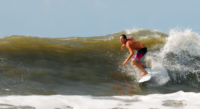
It was waist high but mushy and weak Tuesday morning.  Thought it would be better.  Here are a handful of pictures.  All I have to say.


Told you only a handful.

We watch the tropics....

MikeC
Jul 18, 2011
I feel like a real weatherman now.  I totally underestimated Invest 98 saying, 'it doesn't really matter." Well obviously like true weatherman fashion I got it all wrong.  Number 98 turned into Tropical Storm Bret basically over night.  The storm is currently located off the NW coast of the Bahamas expected to travel N NE over the next several days. 


Development beyond tropical storm status is not expected.  Upper level atmospheric conditions aren't letting it happen.  Bret is no monster but a storm is a storm so expect a punchy waist plus swell tomorrow.  Local Folly winds for tomorrow morning are looking decent for the arriving swell.  

Now I never condone skipping out on work but hey, it's the 'first' tropical swell.  Call in and say you got the D.  On the other hand my weatherman skills showed their colors in my last post.  Whatever happens I'll be out there in the AM.

Here are some pictures from this morning!

Remember the high tides and beach erosion last year?  Here we go again.  One good thing is all that extra sand is off the beach now.

Representin' Follyhood!!!!


sources: NHC, Wunderground

All photos shot with my decrepit 70-300 which loves contrasty shots.  Nikon D300s

See you tomorrow 
MikeC

 
Jul 16, 2011

Why is it so windy at the beach you may ask yourself?  It's because of Invest 98.  She's a disorganized mess of tropical air that can't get her act together.  Even if she did get her act together, 98 is just too close to do anything cool, aka give us waves.

The NHC is saying the upper level winds may begin to organize themselves over the next few days but there is only a 20% chance of 98 becoming a Tropical Cyclone. 

At least something is happening.  Look for disorganized windswell all weekend.

MikeC
Jul 9, 2011

Hi Haters

Too bad the waves didn't get their act together yesterday.  The wind never really cooperated, the rain wasn't hard enough to clean it up, and I didn't feel like getting my camera wet (insert hater comment here).  But lets see whats poppin in the tropics.


AKA.....NOTHINGGGGG :(

....for us

Sure there is an added chance for tropical development in the Gulf of Mexico but like I said last week, it does absolutely nothing for us here.

There is a ray of sunshine though...

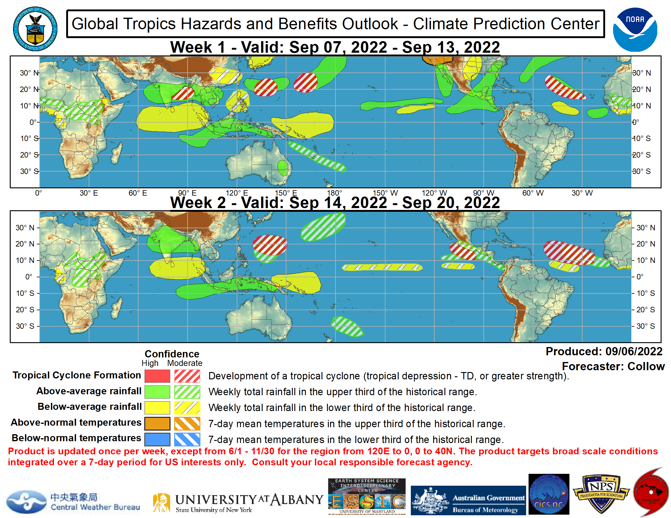
It's tough to see but if you look all the way on the right hand side of map; located on the African coast you'll see a little green and white lined region.  The green and white region indicates the forecasters are expecting above average rainfall.  This is where many of our major hurricanes are born.  Huge tropical rain storms come barreling out of the rain forests of Africa and grow into the monsters we need to produce real waves.

So above average rainfall in the baby making region for hurricanes is a good sign... I think.

Navigate over to the Thomas Bros Blog if you would like to see a few pics from yesterday.

MikeC
Jul 7, 2011

OMG...Waves


First legit summer swell of the year.  The waves currently in the water are from a storm that developed far far away in the tropical Atlantic region.  I was surprised with not only the size and cleanliness of the waves but also the consistency, which are things we rarely see all working together here.  And can you say crowds?  I never even knew that many people lived here. **These photos are all from mid morning. Justin over at FollyHood took some more photos around noon time. Watch for those.**


All I request from you Facebook posters is this 'check out more at follysurf.blogspot.com'  just a lil credit.

MikeC